Find boating guides, marine gear, safety products, dock lines, yacht accessories, and more.
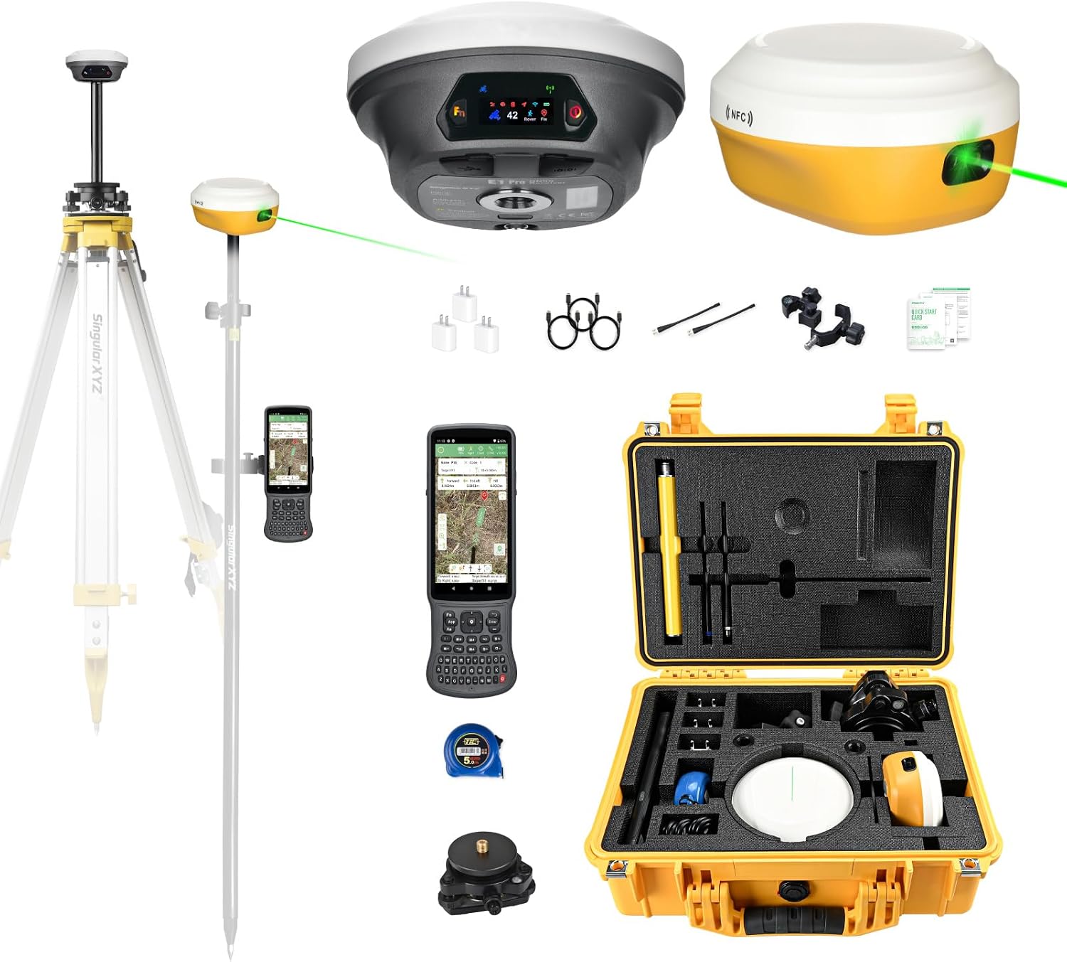
E1 Pro-L1 Laser GPS Rover RTK & Base Station GNSS RTK Survey System, 1.1″ HD Screen, AR Stakeout, 2cm Accuracy, 15km UHF, BT/NFC/PPK/NTRIP, Work as Base for Drones (Includes Tribrach)
Add to wishlistAdded to wishlistRemoved from wishlist0
Smart FAQ
What is the accuracy of the E1 Pro-L1 Laser GPS Rover RTK system?
The E1 Pro-L1 Laser GPS Rover RTK system provides an accuracy of 2cm.
What is the range of the UHF communication for this system?
The UHF communication range for the E1 Pro-L1 is up to 15km.
Does the E1 Pro-L1 support Bluetooth and NFC connectivity?
Yes, the E1 Pro-L1 supports both Bluetooth and NFC connectivity.
Can the E1 Pro-L1 be used as a base station for drones?
Yes, the E1 Pro-L1 can work as a base station for drones.
What type of display does the E1 Pro-L1 have?
The E1 Pro-L1 features a 1.1" HD screen.
Is a tribrach included with the E1 Pro-L1 system?
Yes, the E1 Pro-L1 system includes a tribrach.
AI-generated from available product information. Always verify details on the official listing.
Product Details
The E1 Pro-L1 Laser GPS Rover RTK & Base Station GNSS RTK Survey System is designed for precision surveying with a 1.1" HD screen and 2cm accuracy. It features non-contact laser surveying capabilities, making it suitable for various applications. The device supports full GNSS, ensuring reliable data collection in different environments. With a range of 15km UHF, it can effectively communicate over long distances. Additionally, it includes Bluetooth, NFC, PPK, and NTRIP functionalities, enhancing its versatility. The system can also function as a base for drones, expanding its usability.
1.1" HD screen for clear visibility
2cm accuracy for precise measurements
Full GNSS support for reliable data
Compact design for easy transport
Pros & Cons
Pros
High accuracy of 2cm for reliable results
Versatile with multiple communication options
Compact and portable design
Can be used as a base station for drones
Cons
May require additional training for optimal use
Limited information on battery life
No specific details on warranty or support options
E1 Pro-L1 Laser GPS Rover RTK & Base Station GNSS RTK Survey System, 1.1″ HD Screen, AR Stakeout, 2cm Accuracy, 15km UHF, BT/NFC/PPK/NTRIP, Work as Base for Drones (Includes Tribrach)